 |
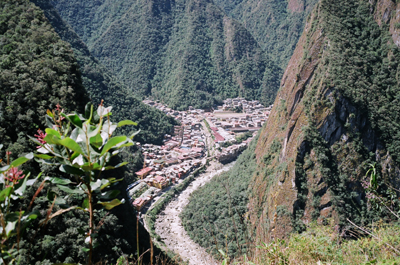
Putukusi Mtn A view of Aguas Calientes from Putukusi Mountain. Aguas Calientes spanish for Hot Water lives up to its name as there are hot springs here that visitors can enjoy. But for a tourist the most important thing is its proximity to Machu Picchu. If you are planning a visit to Peru you should plan to stay a night in Aguas Calientes so the next day you can journey to Machu Picchu. |
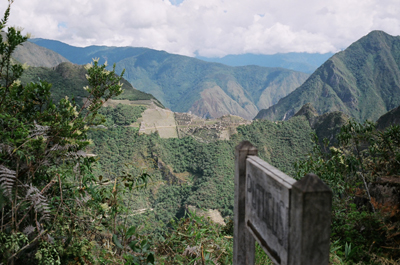 |
Putukusi Mtn A view of Machu Picchu from the top of Putukusi Mountain The top of the mountain is just a 2 hr hike from Aguas Calientes. Pitukusi is on the opposite site of the valley to Machu Picchu and so offers spectacular views of it. The hike is well worth the views it offers of Machu Picchu. |
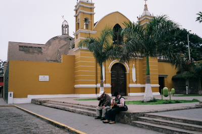 |
Lima, Peru Francisco Pizarro the founder of Lima in 1534 crowned it the "City of Kings" Lima served as the capital of Spain's South American Empire for three centuries. |
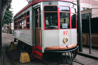 |
Lima, Peru Trolly Car at the Electricity Museum in Lima, Peru Lima's tram cars were built in the 1920s in Italy and operated in the center of thecity. |
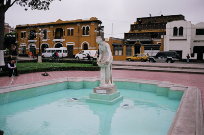 |
Lima, Peru This status is the Daughter of Venus located in the Parque Municipal in the Barranco sector of Lima. A Cararra marble statue of La Donaide (Daughter of Venus). She floats languidly over the clear waters of the central pool. |
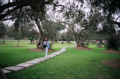 |
Lima, Peru The Olive Grove (The Bosque el Olivar) in the San Isidro section of Lima. It was declared a national monument in 1959. In 1560 Antonio de Rivera introduced the olive tree from Seville. Today the Grove has 1,500 trees. Many of them are centuries old. |
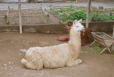 |
Lima, Peru Llama and Alpaca at Huaca Pucllana. |
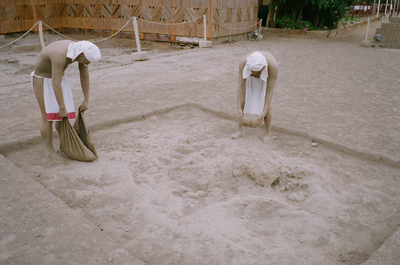 |
Lima, Peru A model of workers making clay. The clay was made by hand and stacked like books in a bookshelf. |
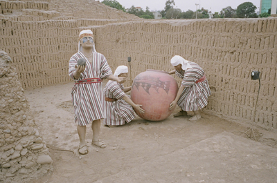 |
Lima, Peru A model of people at Huaca Pucllana which was inhabited in 400-700AD. The workers are handling a clay pot which was thought to be broken in a ceremony. the person in the foreground is a person of importance performing the ritual. |
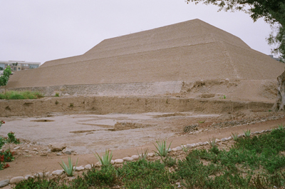 |
Lima, Peru Huaca Hullamarca. A Pyramid dating from about 400-700AD. This is located in the heart of the city of Lima, capital of Peru. |
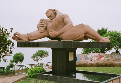 |
Lima, Peru Located in Miraflores section of Lima. The Parque del Amor (Love Park) was inaugurated February 14, 1993. It is devoted to the old Peruvian custome of courting in public gardens. In the center of the park is a colossal statue of a kissing couple. El Beso, or the Kiss by sculptor Victor Delfin. A winding mosaic bench is embedded with names and notes of love. |
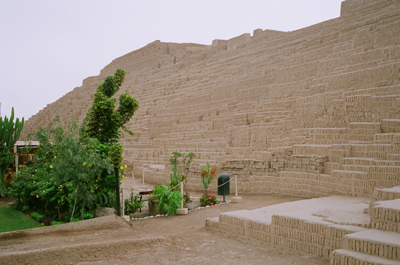 |
Lima, Peru Huaca Pucllana. Small adobe bricks were made by hand and placed in vertical rows like books on a bookshelf to build walls, platforms and pyramid structures. The walls are built using trapezoidal panels up to 10 meters wide. They form enclosures, plazas, ramps, stairs and entrances. Because of their structure and way they were placed the structures were earthquake resistant. |
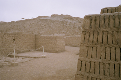 |
Lima, Peru Huaca Pucllana. Pucllana consists of two areas separated by a great wall of adobe bricks running noth to south. To the east of this wall is the administrative sector consisting of a series of plazas and enclosures that may have been used for public meetings to control and improve production. To the west is the ceremonial sector with its pyramid and adjacent plazas, where religious rites and ceremonies were held, conducted by priests that took on the functions of local governors. Pacllana is the Quechua name used in the 16th century for this great ceremonial centre built by people from the Lima culture in between 200-700AD. |
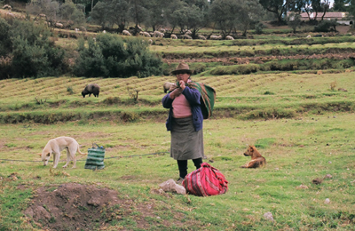 |
Tambomachay, Peru A local in the fields near the ruins of Tambomachay. |
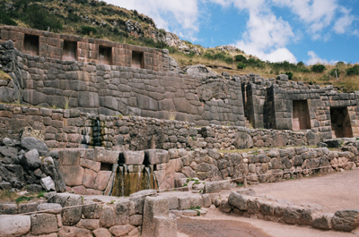 |
Tambomachay Tambomachay, from Quechua meaning resting (Tampu) place (Machay) is an archaological site from the Inca Empire near Cusco. The alternate local name is Bath of the Inca. It consists of aqueducts, canals and waterfalls that run through the terraced rocks. It is 437 square meters, at 3,700 meters of altitude. |
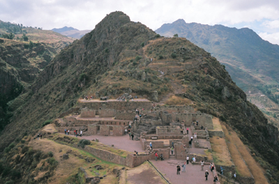 |
Pisac A view of the Pisac Ruins. This used to a Inca Village located at the top of a mountain, large areas of the mountain were transformed into terrace fields. It is located in the Andres Mountains. The Pisac ruins also showed off the Inca's advanced masonry skills without any mortar they joined stone blocks. The voices of the surrounding mountains and valley are breathtaking. Steps and aqueducts carved from stone and the surviving sun temple are impressive. Pisac is also one of the most complete ruins which contain military, agricultural, and industrial sectors giving insight into how the Incas lived. |
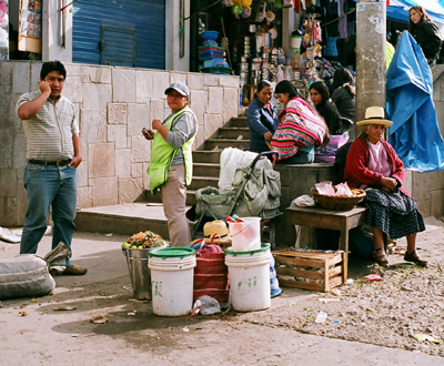 |
Ollantaytambo, Peru Peru's population is 28 million (2009), with a mixture of Amerindians, Europeans, Africans, and Asians. The main spoken language is Spanish but a large proportion speak the native Quechua. Peru is a representative democratic republic with 25 regions. It achieved independence in 1821 from the Spanish. The Peruvian territory was home to the Norte Chico civilization, one of the oldest in the world. |
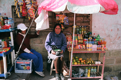 |
Cusco, Peru This little foodstall was at the outskirts of Cusco, near the entrance of Saqsayhuaman where we bought water. At the corner of a sloping street and up against a wall she commands the attention of traffic entering the ruins. |
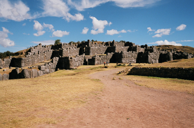 |
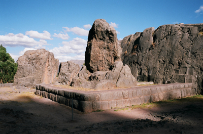
Saqsayhuaman, Peru Saqsayhuaman is a short walk just outside of Cusco. It is built of huge stones weighing 100 tons and perfectly assembled to lock fit without using mortar. This was a fortress where the Inca indians performed sacred rites and held festivals. The imposing fortress was also a refuge used in case of emergency. It is at 3,701 m altitude. The stone are so precisely fit together that a piece of paper will not fit between many of hte stones. This precision with the rounded corners of the limestone blocks and variety of interlocking shapes and inward lean has allowed it to survive earthquakes that Plague Cusco. The longest of the three walls is 400 meters. There was also a system of underground passages known as chincanas which connected it to other Inca ruins within Cusco. |
 |
Qenqo, Peru Qenqo is a vast rocky hilltop carved into staircases, holes and channels, probably built to store the chica (fermented maize beer) used in Inca rituals. Qenqo has semi-circular patios with large niches surrounding a stone figure. It is located 4 km north of Cusco. K'enko is Quechua for Labyrinth. It is located on Socorro hill and is 3,500 square meters. The semicircular "amphitheater is 55m long. The "chamber of the dead" or "chamber of sacrifices" is an underground chamber here which could have been used to embalm the official spies or for human and llama sacrifices. The stones have also channels to allow blood to run. |
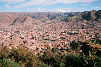 |
Cusco, Peru This is a view of Cusco from Saqsayhuaman. Cusco is in the Urubamba Valley or the Sacred Valley region of the andres Mountains. It is the capital of the Cusco Region in Peru and the Cusco Province. It has a population of 348,935 (2009) and located at an altitude of 3,300 m (10,800 ft). Cusco is the historical capital of the Inca Empire and was declared a World Heritage Site in 1983 by UNESCO. It is designated as the Historical Capital of Peru by the Constitution of Peru. |
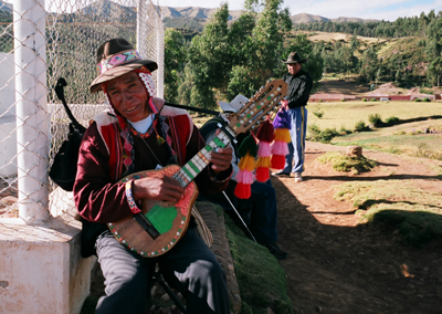 |
Saqsayhuaman, Peru A native American of Peru. The Inca Empire lasted from 1200 to 1532 when the Spanish arrived in 1533. It was the largest empire in the pre-columbian America. The Incas used conquest and peaceful assimilation to incorporate a large portion of western South America centered on Cusco. The official language of the empire was Quechua. The name for the empire was Tawantinsuyu (The Four united Regions). In 1532 Francisco Pizarro with 168 men, 1 cannon and 27 horses came to conquer the region. At the time the Inca had fallen into civil unrest and a war of the two brothers between Huayna Capac's sons Huascar and Atahualpa. Smallpox had also weakened the empire. |
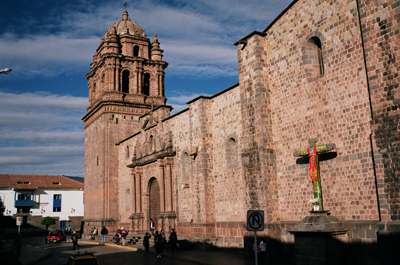 |
Cusco, Peru Santo Domingo Church on Avenida El Sol. It was consecreated in 1654 and incorporates the foundations and walls of Koricancha (Quechua for Golden Enclosure or Golden Garden). It was dedicated to Viacocha, the creator deity and Inti the sun God. It was also known as the Temple of the Sun. |
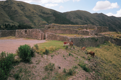 |
Puka Pukara, Peru This fort is nestled in the Sacred Valley. It means "Red Fortress" it was believed to have been a military checkpoint. The complex has warehouses, sprints, and aqueducts and homes. It i slocated 9km northeast of Cusco. Puca Pucara has reddish walls and it has the remains of what seemed to have been watch towers. It has interior squares and staircases as well. The proximity to Tambomachy is important. The Inca rulers are said to have left part of their army and followers at Puca Pucara when visiting the Tambomachay Baths. |
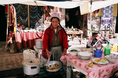 |
Pisac Village, Peru A local in the Pisac Mercado (market) is making food. Lunch here was 4 Nueva Soles (Peru currency). 3 Soles = 1 USD. So lunch was $1.33. We had a lunch of Rice, Vegetables, and Soup. |
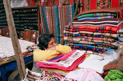 |
Pisac Market, Peru The labyrinthian market of Pisac is an immense collection of merchants selling a huge variety of food and local handicrafts. The friendly Indians come to sell their wares in the time honour way. there are souvenirs, antiques, weaves, jewelry, and all manner of clothes made from alpaca wool. |
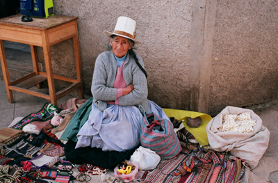 |
Pisac Market, Peru A lady sells a variety of good at the Pisac Market. |
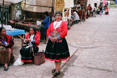 |
Pisac Market, Peru A native American Indian near the end of a Spur at the Pisac Market. They are friendly and you see dressed in the native traditional clothing of the Indians. |
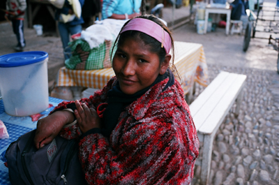 |
Pisac Market, Peru Because I am a ASL instructor, I noticed that this person was deaf. So I strated to communicate with her in Sign Language. Many of the Sign words used in Peru are the same with ASL. Her name is Yeni which she scrawled on her hand with scissors before I could stop her. She understood what my name was just with basic ASL fingerspelling. |
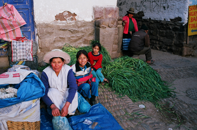 |
Pisac Market, Peru People preparing vegestables at the Pisac Market. |
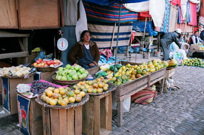 |
Pisac Market, Peru A food vendor at the Pisca Marcado. |
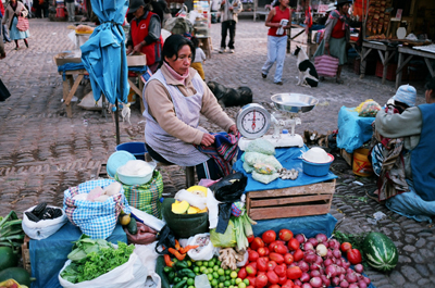 |
Pisac Market, Peru A food vendor at the Pisca Marcado. |
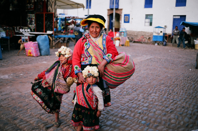 |
Pisac Market, Peru A local Indian at the Market with her two children. |
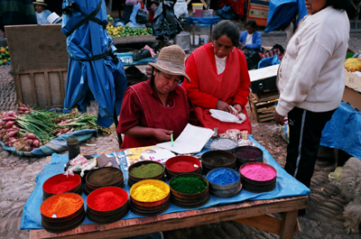 |
Pisac Market, Peru A lady selling material that can be used for painting. Pigments. I asked what who were "Utilidad?" and she demonstrated a tiny bit of the pigment can be used with water to form a watercolor. |
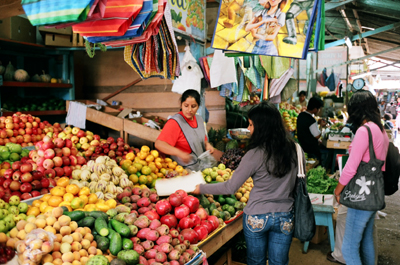 |
Puerto Maldonado, Peru The local mercado at Puerto Maldonado. A lady sells a large variety of fruits and vegetables in an open air market. |
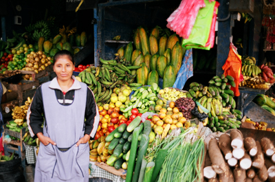 |
Puerto Maldonado, Peru Another vendor at the Market at Puerto Maldonado. |
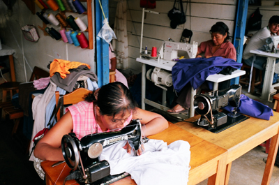 |
Puerto Maldonado, Peru A seamstress at the market takes requests to mend clothes. |
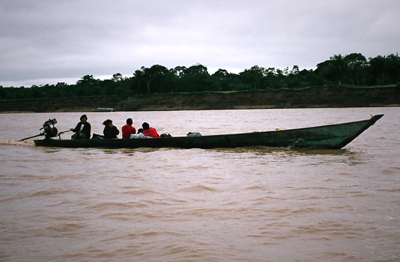 |
Amazon River, Peru The Amazone Basin is a large portion of Eastern Peru. This part of the Amazon river is fed from the Madre de Dios (Mother of God) river which becomes the Beni River in Bolivia which is a tributary to the Amazon River. Mango farming, logging, farming and Gold mining are the industries along its beachers. |
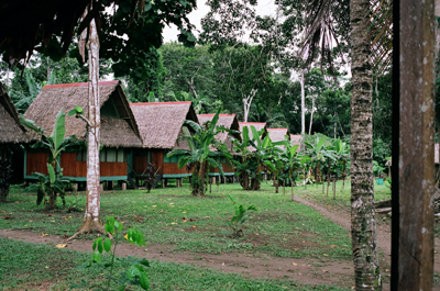 |
Tambopata Candamo National Park This is the Tambo lodge in the Tambopata Candamo National Park. These Ledges are where we stayed at during our stay in the Amazon Jungle Basin. It was warm every day around 70-80 degrees F, full of lush vegetation and life. |
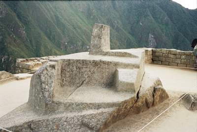 |
Machu Picchu, Peru This is Inithuatana ("sun tier") and is believed to have been designed as an astronomic clock or calendar by the Incas. The Intihuatana stone is one of many rigtual stones in South America. The stone was arranged to point directly at the sun during the winter solstice. Intihuatana is also called the Hitching Point of the Sun because it was believed to hold the sun in its place along its annual path in the sky. At mid day on March 21 and September 21, the Equinoxes, the sun stands almost above the pillar of Intihuatana casting no shadow at all. |
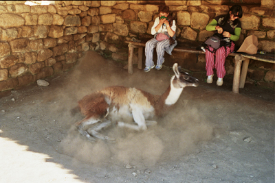 |
Machu Picchu, Peru Alpaca is rolling in the dust in order to cool down and keep insects away. Unfortunately for the people on the seat they are caught in the wake of the dust storm.- Both Alpaca and Llama inhabit Peru. Llama have longer necks. Alpacas inhabit Peru, Bolivia and Chile at high altitudes. Alpaca fiber is used for making knitted and woven items from their coats. The alpaca fiber comes in over 52 natural colors. Alpacas also have straight ears and llamas have banana shaped ears. Llamas are bred to be beasts of burden while Alpaca are not. |
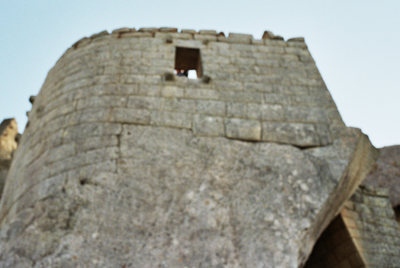 |
Machu Picchu, Peru This is the Temple of the Sun at Machu Picchu. Machu Picchu was divided into three great districts: the Sacred District, the Popular District in the south and the District of the Priests and the Nobility. |
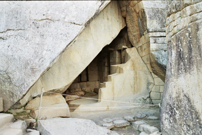 |
Machu Picchu, Peru This is the Royal Tomb. The steps represent the three levels of existence in the Inca World. The snake (underworld), Puma (present) and condor (celestial world). Machu Picchu is built of rock at an atltitude of 7,710 ft on the saddle of a mountain flanked by sheet drops to the Urubamba Valley below. Agricultural terraces were cut into the mountainside and provided food for up to 1,000 inhabitants. It still remains a mystery how the Incas were able to chisel and transport such large blocks of granite that comprise Machu Picchu. |
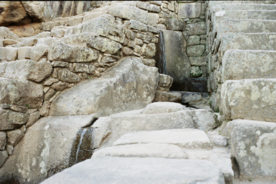 |
Machu Picchu, Peru This is the Fountains at Machu Picchu. You can see two fountains in the picture. There are a series of fountains that run the length of the site. The water foundtains were interconnected by channels and water drains perforated into the rock and designed to be an irrigation system. Evidence has been found which suggests that the irrigation system was used to carry water from a holy spring to each of the houses. The Incas harnessed a natural spring located on a steep slope to the North of Machu Picchu. They built a 2,457 foot long canal. to bring water down to the city. They channeled the water down a series of 16 fountains( a stairway of fountains). Each fountain has a rectangular spout to produce a stream of water designed to fill a urpu (tall necked clay jug). |
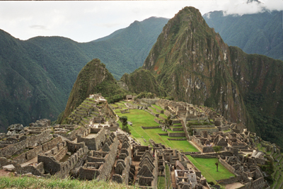 |
Machu Picchu, Peru Machu Picchu in Quechua means "Old Peak". It is a pre-columbian Inca site at an altitude of 2,430 meters (8,000 ft) of altitude. It is on a mountain ridge above the Urubamba Valley. It is often referred to as the Lost City of the Incas. The Incas started building it around 1430AD and was abandoned a hundred years later. |
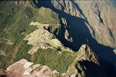 |
Machu Picchu, Peru Machu Picchu was declared as a Peruvian Historical Sanctuary in 1981 and a UNESCO World Heritage Site in 1983. Since it was not plundered by the Spanish it is considered a sacred place. In 1911 Hiram Bingham an American historian brought Machu Picchu to international attention. |
| Lima, Peru Vendors sell food on the street corner in the heart of the historical sector of Lima. | |
| Lima, Peru This is the Plaza de Armas (Plaza of Arms) or the Main square of the historical center in Lima. The square is ringed by City Hall, the Government Palace, and the Cathedral. | |
| Lima, Peru A person shines another person's shoes on the streets of Lima. | |
| Lima, Peru The Cathedral of Inglesia de Santo Domingo in Lima. | |
| Lima, Peru A vendor sells Mandarin Oranges in front of the Inglesia de Santo Domingo in the historical center of Lima. | |
| Lima, Peru A person sells newspapers in the historical center of LIma. | |
| Lima, Peru A typical building in Lima. | |
| Ollantaytambo A cook at the El Chasqui restaurant. | |
| Machu Picchu, Peru Machu Picchu was built using their famous rock handling techniques. They are polished dry stone walls fitted together without the use of mortar. This technique is called Ashlar. The blocks of stone are cut to fit together tightly and were more earthquake resisteant than using mortar. The Incas used mortar but it was considered quick and shoddy construction. It was constructed around 1462, at the height of the Inca Empire. It was abandoned less than 100 years later most likely because the inhabitants were wiped out by smallpox before the Spanish conquistadores arrived in the area. When the Spanish arrived they did not know about this remote city. | |
| Machu Picchu, Peru Machu Picchu is located only 50 miles from Cusco, the Inca capital. But it was never found by the Spanish and consequently not plundered and destroyed as was the case with many other Inca sites. Eventually over the centuries the surrounding jungle grew over much of the site and few knew of its existence. A local 11 year old Quechua boy named Pablito Alvarez led Hiram Bingham an American historian lecturer at Yale University to it on July 24, 1911. It is located at the crest of the mountain Machu Picchu at an altitude of 7,710 feet which is 3280 feet below the altitude of Cusco. | |
| Machu Picchu, Peru The Incas never used the wheel in any practical manner. Though its use in toys demonstrates they were aware of the principle. They did not have strong draft animals and dense vegetation made wheels impracticle. | |
| Machu Picchu, Peru The ceremonial rock at Machu Picchu. Note how the rock mirrors the shape of the mountain in the background. Note the Alpaca in the foreground. | |
| Machu Picchu, Peru The Depositos Qolqas Storage huts next to the Agricultural terraces used by the Incas. | |
| Machu Picchu, Peru Chinchilla. Meaning little Chincha, named after the Chincha people of the Andes. They are crepuscular rodenst slightly larger than squirrels native to the Andes Mountains of South America. By the end of the 19th century they had become rare due to hunting for their dense fur. The first reference to them was in 1599 by father Jose Acosta. In 1900 Frederico Albert successfully bred them in captivity. They are agile and can jump 5 feet. If biten by a predator they can spray urine and release fur. | |
| Machu Picchu, Peru The Temple of the Condor. This temple earned its name from the two slabs which form the bird's stylized outspread wings, and the head defined by the carved rock on the ground. Hiram Bingham tagged this area as the prisons during his expedition because of the dank subterranean dungeons and the niches above the building in which he believed prisoners were held and lashed. Historians believe though that the niches were altars which mummies were placed during the ceremonies that were devoted to the condor, one of the most important Inca Deities. | |
| Machu Picchu, Peru Storage huts. | |
| Aguas Calientes Aguas Calientes. | |
| Putukusi Also spelled Putucusi, the word is Quechua for Happy Mountain. It is a mountain located on the opposite side of the Urubamba (Vilcanota) river to Machu Picchu. It is 8,500 feet (2,560m) above sea level at its peak and offers spectacular views of Machu Picchu. Putucusi, Machu Picchu (Old Peak) and Huayna Picchu (Young Peak) are considered holy mountains by the Quechua. The defining element of Putucusi is the 1.5 hour hike to the top with 1700 wood and stone steps with many ladders. The tallest ladder is 100 feet. A host of native flora cover the mountain including pisonayes, qeofias, alisos, puya palm trees, ferns, and orchids. | |
| Aguas Calientes Parrot at Aguas Calientes. There are 372 species of Parrots found in warm and tropical regions. The greatest diversity of Parrots is found in South America and Australasia. They has strong curved bills, upright stance, strong legs, and clawed zygodactyl feet. Parrots along with ravens, crows, jays and magpies are some of the most intelligent birds. | |
| Cusco, Peru A Quechua local of Cusco selling alpaca knitted goods. | |
| Cusco, Peru This was a demonstration or strike in Cusco. People were peacefully demonstrating at the main square (Plaza de Armas). Drums, and chanting completed the gathering. The strike lasted for one day, and it was difficult to get a train or taxi during that time. | |
| Saqsayhuaman Llamas. You can see the Inca fortress of Saqsayhuaman in the background. | |
| Cusco Locals at Santo Domingo Church in Cusco. The colorful knits are commonly worn by the locals. Because of its altitude Cusco can be pretty cold at night reaching freezing temperatures in the Fall (when we visited). | |
| Cusco This is the Cathedral of Cusco, (La Cuidad Imperial) located at the Plaza de Armas in the center of town. Cusco is derived from the Quechua phrase "qusqu wanka" which means "rock of the owl". The original city of Cusco was built in the 11th century. The Killke occupied the region from 900-1200AD. Cusco was the capital of the Incan Empire (1200-1532). According to Inca legend, the city was built by Sapa Inca Pachacuti who transformed Cusco into the vast empire of Tahuantinsuyu. | |
| Cusco Local native dance performance by the locals of Cusco. Traditional Peruvian dances are performed by El Centro Qosqo de Arte Nativ (Cusco center of native art). Zoila Mendoza in "Shaping society through dance" writes that the locals see it as rescuing and reinventing cusqueno rituals, music, and dance from extinction. | |
| Cusco Traditional customes and dress of the Quechua people. | |
| Cusco A Local dance performance at the Le Retama restaurant just off of the Plaza de Armas. | |
| Puca Pukara People are selling goods at the Inca ruins of Puca Pukara. | |
| Tambomachay A Quechua resident of Tambomachay. | |
| Pisac A person moves a cargo bicycle at Pisac village. | |
| Pisac Locals near the town of Pisac | |
| Pisac Pisac was a Inca village in the Sacred Valley on the Urubamba River. The inca ruins are known as Inca Pisac which lie at the top of a hill at the entrance to the valley. The ruins are separated into four groups, Pisaqa, Intihuatana, Qallaqasa and Kinchiracay. Intihuatana includes a number of bathes and temples. The temple of the sun served an astronomical function. Pictured here is the Q'allaqasa, built onto a natural spur and overlooks the valley and is known as the citadel. | |
| Inca Pisac Note that Inca Pisac has many agricultural terraces which were constructed by the Inca for cultivating crop plants. these terraces were created by hauling richer topsoil from lower lands by hand. They enabled them to produce surplus food than would normally be possible at altitudes as high as 11000 feet. | |
| Inca Pisac Pisac had military, religious and agricultural structures all in one site and thus is regarded as an important historical and archaeological site as it gives insight into the Inca people. It is throught that Pisac defended the southern entrance to the Sacred Valley. Inca Pisac controlled a route which connected the Inca Empire with the border of the rain forest. | |
| Inca Pisac Pisac Inca was most likely built no earlier than 1440. It was destroyed by Pizarro and the Conquistadores in the early 1530s. | |
| Pisac A view of the Market at Pisac. Pisac was built by Viceroy Toldeo during the 1570s. | |
| Pisac Pisac village is well known for its market every Sunday, Tuesday and thursday. This event attracts tourists from nearby Cusco. Many andean handcrafts, and woven items made from Alpaca wool are on display here for sale. | |
| Puerto Maldonado the main street at Puerto Maldonado near the Central Market. | |
| Amazon Basin A canoe ride at Tambopata Candamo National Park at Lake Sandoval | |
| Lake Sandoval A view from the canoe at Lake Sandoval. The lake is inhabited by many kinds of wildlife including caiman (alligators) and Giant Otters. | |
| Lake Sandoval The Hoatzin (Opisthocomus Hoazin) is also known as the Hoactzin, Stink bird, or Canje Pheasant. It is a tropical bird found in swamps, forest and mangrove of the Amazon. It is the only member of the genus Opistocomus (greek for wearing long hair behind). It is herbivorous, eats leaves and fruit and has an unusual digestive system with an enlarged crop which functions as a rumen. | |
| Lake Sandoval Stink birds (Hoatzin) was originally described by German Zoologist Statius Muller in 1776. It is the most enigmatic living bird in regard to its phylogenetic relationships. Because of its distinctness it has been given its own family. Fossil record link this to the Miocene era because of the cranium, domed, rounded and shortened. It might also be a basal member of the Metaves for problematic bird famiies such as flamingos, grebes, and tropic birds. | |
| Amazon Basin Bats | |
| Amazon Basin Capuchin Monkey. These monkeys are classified as genus Cebus. They range from Central America and South America. The word derives from a group of friars named the Order of Friars Minor Capuchin, who wore brown robes with large hoods covering their heads. Explorers in the 15th century found monkeys who resembled these monks. They weigh from 3-9lbs with brain mass of 35-40grams. Capuchins are diurnal and arboreal. They spend the entire day searching for food. At night they sleep in the trees, wedged between branches. The diet of the capuchins is more varied than other monkeys in the Cebidae. They are omnivores eating not only fruits, nuts, seeds, and buds, but also insects, spiders and eggs and small vertebrates. They live together in groups of 10-35 members. The groups consist of related females and their offspring. They are usually dominsted by a single male. Capuchins are considered the most intelligent New World Monkey. They are one of the few examples of primate tool use other than by apea. They will use stones to crack own palm nuts. Young watch and learn from the olders. During the mosquito season they crush up millipedes and rub the remains on their backs which act as a natural insect repellent. Self-awareness. When presented with a reflection, capuchin monkeys react in a way that indicates an intermediatee state between seeing the mirror as another individual and recognizing the image as self. Most animals react to seeing their reflection as if encountering another individual they don't recognize. | |
| Lake Sandoval Local porters at the trail to Lake Sandoval trek through the muddy trail to bring supplies to a lodge in Lake Sandoval. | |
| Tambopata Candamo National Park Macaw at the Tambo Lodge in Tambopata Candamo National Park. | |
| Tambopata Candamo National Park Butteryfly at Tambo Lodge in Tambopata Candamo National Park | |
| Tambo Lodge Dinner at the Tambo Lodge. | |
| Tambo Lodge Dinner at the Tambo Lodge. | |
| Lima Police officers in Lima | |
| Aguas Calientes Gina and Annie | |
| Piranha Piranha are omnivorous freshwater fish which live in South American rivers. They have sharp teeth and a voracious appetite for meat. Piranha are found in the Amazon basin, Orinoco, and the rivers of the Guyanas. Piranha are normally 6-10 inches long with the longest up to 18". There are four genera Pristobrycon, Pygocentrus, Pygopristis, and Serrasalmus. All piranha have a single row of sharp teeth, tightly packed and interlocking. they are used for rapid puncture and shearing. Piranha are both predators and scavengers. | |
| Puerto Maldonado Boa Constrictor. They are found in Central America, South America and some Caribbean islands. They can reach lengths from 3-13 feet (1-4 meters). The largest ever observed was 18.5 ft (5.5m) They can weigh 27kg( 60lbs). They are generally brown, grey or cream color with a brown or reddish brown pattern. They are solitary animals, nocturnal. They flourish in a wide variety of environmental conditions from tropical rainforests to and semi-desert country. | |
| Tambo Lodge People in our tour group at Tambo Lodge. | |
| Amazon Jungle, Peru This is a Capybara. Taken on a night trip in the Amazon Jungle. Capybaras are the largest living rodent in the world. Its common name Kapiyva (Guarani) means Master of the Grasses. Scientific name Hydrochaeris (Greek for Water hog). Barrel shaped with a short head slightly webbed feet and no tail with 20 teeth. The adults can grow to 4.3 ft (130cm) and weight up to 140lb (65 kg). The top recorded weight is 232lbs (105kg). Capybaras can be found throughout nearly all of South America, espeically in the Amazon basin region. Capybaras are herbivors eating mainly grasses and plants. An adult will eat 6-8 pounds of grasses per day. Capybaras are coprophagous eating their own feces for gut flora to help digest cellulose. Also they regugitate food to masticate the food again like cud chewing by a cow. They are social animals found in groups from 10-30. They communicate by scent and sound (purr, bark, whistle, click, squeal, grunts). Excellent swimmers underwater up to 5 minutes. Lifespan 4-8 yrs in the wild and are a favorite food of Jaguar, Puma, Ocelot, Eagle, Caiman, Anaconda. | |
| Lake Sandoval Canoe trip at Lake Sandoval | |
| Lake Sandoval Passionfruit flower at Lake Sandoval. The passion fruit is cultivated for its fruit it is native to South America. Passionfruit juice or syrup is used in a variety of desserts, drinks, and food dishes. The passion fruit is known to be high in vitamin A, vitamin C, potassium and fiber. | |
| Sandoval Lake The tour group poses at Lake Sandoval | |
| Tambopata Candamo National Park
Red Macaw Maria at Tambo Lodge. They are a kind of New World parrot. Of the different Psittacidae (true parrots) six are classified as macaws: Ara, Anodorhynchus, Cyanopsitta, Primolius, Orthopsittaca, and Diopsittaca. Large, dark beaks, hairless, light colored, medial facial areas distinguish macaws. Macaws are known to eat clay, which is believed to work as an antidote to the poisonous seeds they eat. The chemicals in the clay mix with the poison allowing it to pass through the bird's digestive system without harming the bird. | |
| Puerto Maldonado Landing at Puerto Maldonado | |
| Lima Guinea Pigs. They are a rodent belonging to the family Caviidae and genus Cavia. They originated in the Andes. They serve as food for indigenous South American groups and also in folk medicine, and in community religious ceremonies. Biological experimentation on guinea pigs has been carried out since the 17th century. The animals were frequently used as a model organism in the 19th and 20th centuries, giving way to the meaphor guinea pig for a test subject. But have been since replaced by other rodents such as mice and rats. The common guinea pig was first domesticated as early as 5000 BC for food by Andean tribes of South America. The Moche people of ancient Peru worshipped animals and often depicted the guinea pig in their art. The scientific name of the common species is Cavia porcellus, latin for Little Pig. Guinea pigs are large for rodents weighing between 1.5-2.5 pounds and from 8-10 inches. They live 4-5 years They are not found naturally in the wild. Cavia are found in the wild and found in grassy plains. They are crepuscular tending to be most active during dawn and dusk when it is harder for predators to spot them. |